Indoor Mapping MCP
Automating IMDF for Google Content Partners
The Context & Problem
Bringing large venues (stadiums, malls, airports) into the digital world requires strict compliance with the Indoor Maps Data Format (IMDF). For Google Maps Content Partners (GMCP), this process was historically a massive bottleneck.
The Old Way
- Manual Tracing: GIS engineers manually georeference PDF floor plans.
- Slow Process: Takes 2 to 3 days per venue to map.
- Error-Prone: Manually generating 16 GeoJSON layers leads to structural mistakes.
- High Rejection Rate: Failing any of the 50+ Google Maps schema rules restarts the process.
The MCP Solution
- Automated Extraction: Node.js and Python pull geometries directly from PDFs.
- Lightning Fast: Fully packaged ZIP delivered in ~15 minutes.
- Built-in Validator: AI agent cross-references relationships and alignments automatically.
- Zero Rejections: Actionable warnings fix issues before submitting to Google.
How the AI Pipeline Works
I built a unified Model Context Protocol (MCP) server that encapsulates the entire IMDF workflow into 5 deterministic steps. This allows AI assistants (like Claude) or automated scripts to handle geospatial reasoning without human intervention.
Example Workflow via MCP
Results & Business Impact
By transforming a manual GIS task into a programmatic API, this open-source tool allows startups and agencies to scale indoor mapping projects rapidly. It clears the path for developing advanced wayfinding apps, seamless indoor-outdoor navigation, and rich immersive views for retail and real estate.
Next Steps & Roadmap
- Support for multi‑building campuses and improved outdoor-indoor transition layers.
- Integration with direct Google Maps Content Partners upload API for push‑button submission.
- Additional AI‑powered floor plan cleanup using computer vision to correct OCR artifacts from old architectural drawings.

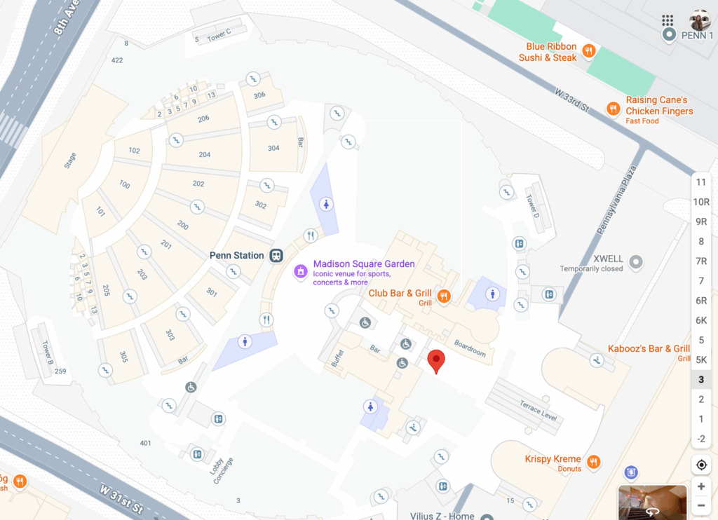
Example of an immersive view output enabled by automated IMDF.